In the past, I used Android – Torque, and an upload to Dropbox, to gather car-tracks.
I’ve started up that project again – this post focuses on my solution for gathering car-tracks for later processing.
 Android-Tablet-Always-On
I got a Samsung Galaxy Note Tablet used, and I’ve stuck it in the glove compartment of my car. Its plugged in to power, but power only runs when the car is turned on. Click on image to zoom.
I use automate-it to run a few rules:
- When power goes off, go into airplane mode.
- When power comes on, turn off airplane mode, and start MyCarTracks
This seems to work as long as I drive a good amount each day. Then again, when I went to write this blog post, I found the tablet powered completely off – not enough charging? temperamental battery? Looks like not enough charging is the culprit.
It would be awesome to completely shut down the tablet when power is lost, and then power on when power is applied; however, I’d have to jailbreak to get that, and my 15 minutes at attempting to jailbreak, didn’t work, so, meh.
MyCarTracks
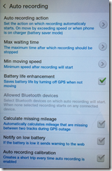
 I could totally get by with the free version of MyCarTracks. Its an excellent product! It has these features which I use:
- Auto-record car tracks – after you reach 6 miles per hour
- Auto-stop recording car tracks – when still for 5 minutes.
I can then get access to my tracks via an “Export All” feature, which will let me export to CSV, GPX, or KML. GPX is the winner for me:
<?xml version=”1.0″ encoding=”ISO-8859-1″
standalone=”yes”?>
<?xml-stylesheet type=”text/xsl” href=”details.xsl”?>
<gpx
version=”1.0″
creator=”MyCarTracks”
xmlns:xsi=”http://www.w3.org/2001/XMLSchema-instance”
xmlns=”http://www.topografix.com/GPX/1/0″
xmlns:topografix=”http://www.topografix.com/GPX/Private/TopoGrafix/0/1″ xsi:schemaLocation=”http://www.topografix.com/GPX/1/0 http://www.topografix.com/GPX/1/0/gpx.xsd http://www.topografix.com/GPX/Private/TopoGrafix/0/1 http://www.topografix.com/GPX/Private/TopoGrafix/0/1/topografix.xsd”>
<trk>
<name><![CDATA[2015-04-15 19:52]]></name>
<desc><![CDATA[]]></desc>
<number>29</number>
<topografix:color>c0c0c0</topografix:color>
<trkseg>
<trkpt lat=”38.242019″ lon=”-85.72378″>
<ele>132.89999389648438</ele>
<time>2015-04-15T23:52:25Z</time>
</trkpt>
<trkpt lat=”38.241821″ lon=”-85.723613″>
<ele>131.89999389648438</ele>
<time>2015-04-15T23:52:29Z</time>
</trkpt>
<trkpt lat=”38.241649″ lon=”-85.723491″>
<ele>129.1999969482422</ele>
<time>2015-04-15T23:52:32Z</time>
</trkpt>
MyCarTracks.Com
But Wait There’s More!
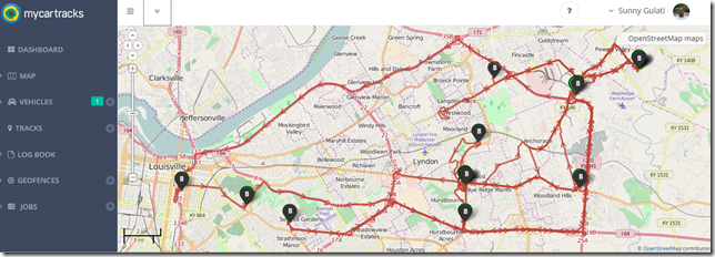
 I went ahead and paid them $16 for a 1-year service for a small fleet, which gives me access to my tracks online (up to 2 years old) for quick viewing. In order to make this happen, I sometimes hook up the tablet to my WIFI and say “synchronize all”. There’s also an option where I can say “sync between 2 and 3 in the morning”, and I configure automate-it to take airplane mode off from 2-3, however, that’s hit or miss.
Once the tracks are loaded up to MyCarTracks.Com, I can browse them on a pretty nice map. (picture at the top of the post).
What’s Next
My intention is to load these GPX’s into a small sql-server database, using Spatial (Points), and then come up with little data sets of “here’s all the tracks that passed through these two points”, etc.
I then want to take those tracks and convert them to a 3-D rendering with Z-axis = time, to compare various paths with each other.
And I want to convert that into a 3-D sculpture. Because, art. My art. Representation, archival – these I love.
But, one thing at a time. I’m always welcome to shelf my projects; I only work on them when they are attracting my soul. Might be a bit before I get there. I do have a start on the gpx-parsing code, though: https://github.com/sunnywiz/cartracks2016


