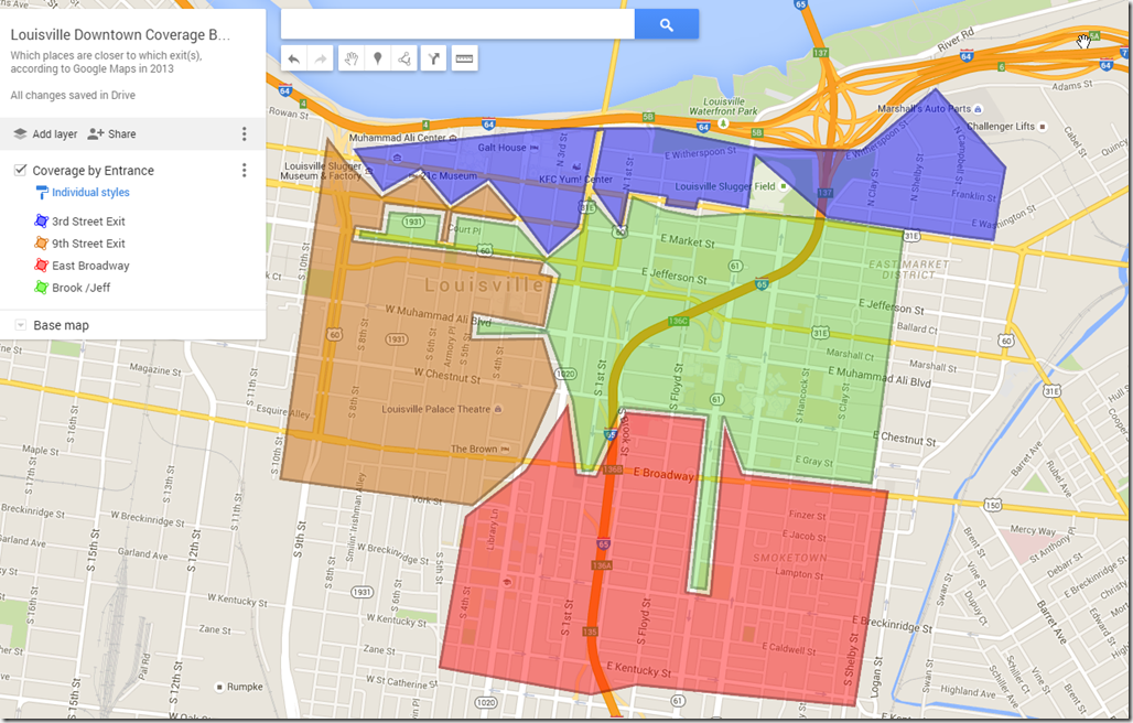
Here’s a quickie but oldie. When I started going downtown more often for various reasons, I decided to study the layout a bit. I ended up drawing this map:
I did this by having two google maps open; I would then do a route in one, and drag the endpoint around; as I discovered when things “switched”, I would update the map in the other window. I often had to stop and wait because I ran out of API calls per minute. I’d love to write (or have someone write) an equivalent program, something that colorizes the 2D space of google maps by some function of a route to that spot.
Here’s a readonly link to the map that I made.
It will be fun to re-update this after the bridge work is done to see how things might have changed.


