https://github.com/sunnywiz/TreeOfDirection/commit/8058bc3598c189ded425f044bde39528e335d4fd
This was supposed to look pretty, but its not.
If I look at the simpler version in an isometric top down view, it might make more sense:
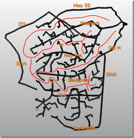
This is taking a grid of points on a map, and asking Google for the optimal route from home to that point. This ends up creating .. I don’t know what to call it. Its a decision tree, says Lamont .. yes, that’s a good name for it. It also points out that Google has forgotten that a certain street doesn’t go through, and is incorrectly routing me down Old Henry Rd.
I’ve added something in red .. its the boundaries between “neighborhoods”. Also note that 3 routes almost touch where my current work is, which is why there’s so much indecision about the “best” route to work. Whereas, if you’re in the middle of a particular neighborhood, then there’s little choice. This says the best way for me to get to the new work place will be 146->HurstBourne.
I think this is better done staying as a 2D print. I might need to learn.. PdfKit? Something to generate PDF’s with. I can get a poster-sized PDF printed for $5 via Office Max. However, what I might do is overlay a few maps .. like “with heavy traffic” vs “without”, with transparency. And a lot more detail.
I did learn a lot about using Google’s Directions API. Very nice. Polylines are pretty amazing – took a small string and it decoded into 22 points!!! https://developers.google.com/maps/documentation/utilities/polylinealgorithm.
More to follow, I’m sure.


